
Features rfsBuddy
GPS Mapping Co-ordinates - Record & Share, Field Notes, Movement Tracking & HandbookFEATURES• RFS Buddy works anywhere• The RFS Buddy app does not need wifi or any phone carrier’s reception to work.• RFS Buddy works directly from phoness internal GPS.Developed to assist Australian volunteer Bushfire Fighters from the NSW Rural Fire Service (RFS), and also anyone that need GPS location services.RFS Buddy translates your GPS location into the main RFS MGRS standard, including the LPI Map name and number.
Also includes a number of other formats, and a Fire-ground Field Notes feature to record reference points of interest such as hazards, smoke etc.GPS CO-ORDINATES IN 5 FORMATS1.
RFS MappingThe Standard MGRS format used to match the RFS maps used in the field.
Includes:- Full RFS Grid Reference (100m).- Short RFS Grid Reference- LPI Map Name, Reference Number & Scale- GPS Accuracy2.
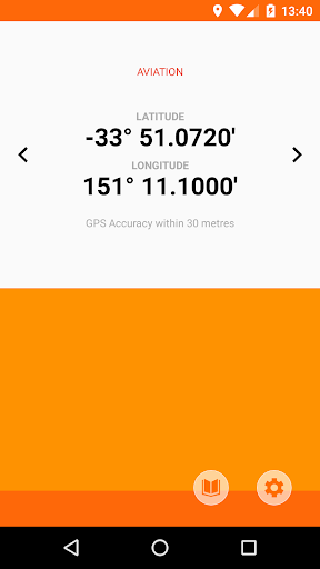
Aviation3.
Standard GPS4.
Degrees, Minutes, Seconds5.
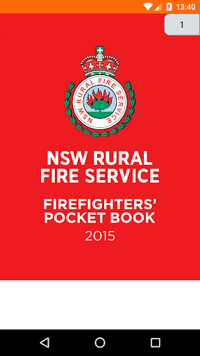
Easting NorthingRFS FIREFIGHTERS POCKET BOOKA useful reference tool to always have on hand.
This copy has a scrolling menu to easy get to the page you need.
Also bookmarks, sharing and printing features included.
Social Features
Connect and share with friends and the community.
Fitness Tracking
Track your workouts and monitor your health metrics.
Travel Features
Plan and manage your travels with ease.
See the rfsBuddy in Action
Get the App Today
Available for Android 8.0 and above